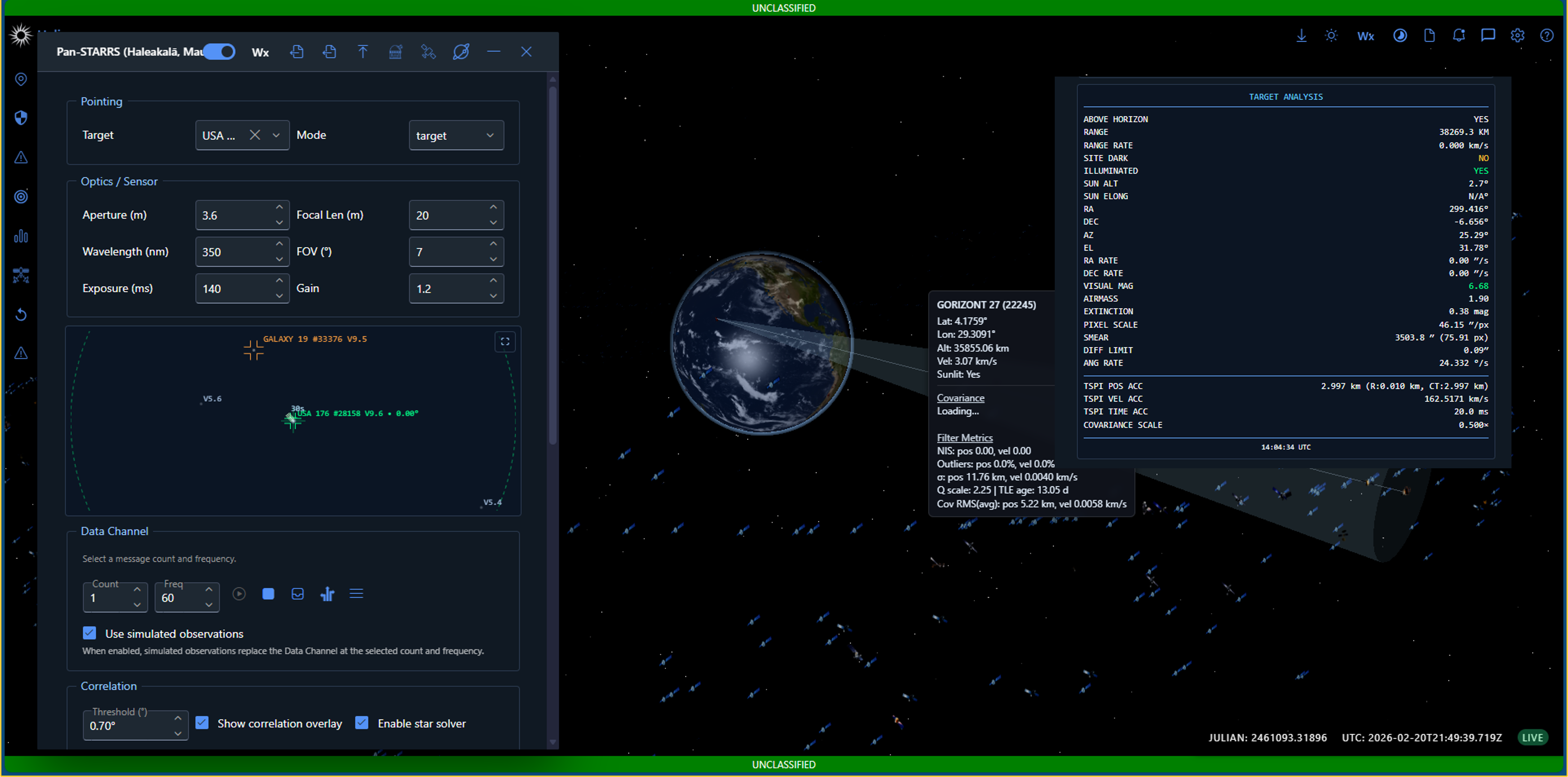
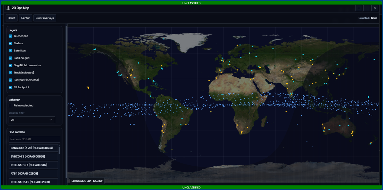
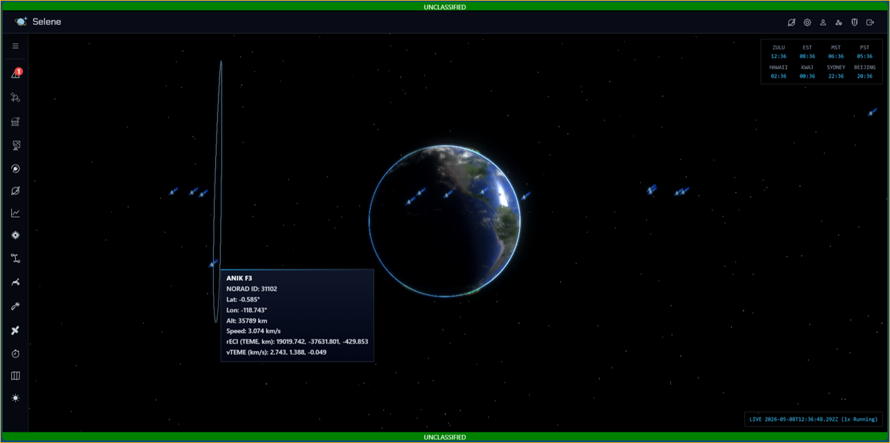
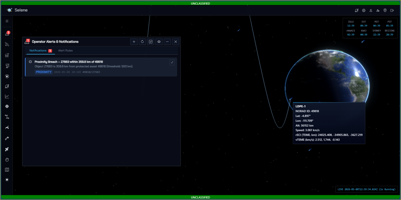
The SDA enterprise requires transparent, repeatable, and explainable analytics to evaluate algorithms, understand estimator behavior, and compare modeling approaches. Selene is an experimental Space Domain Awareness (SDA) analytics prototype built to deliver residual‑driven evidence, multi‑sensor experimentation, and truth‑anchored research inside a modular, interactive 3‑D web environment.
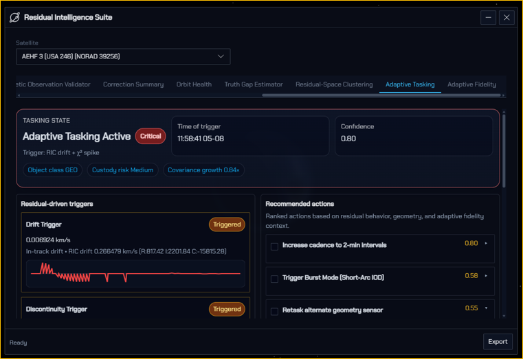
By analyzing residual bias, drift, discontinuities, and non‑random structure, Selene provides sensor‑agnostic indicators of maneuvers, anomalies, and sensor/track degradation—offering a transparent, explainable environment for experimentation and evaluation.
Residual Intelligence Suite (RIS)
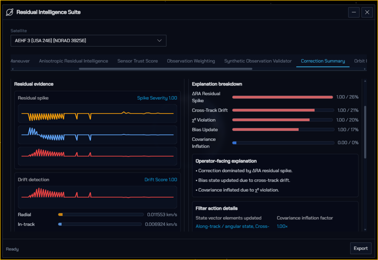
Selene is anchored by the Residual Intelligence Suite (RIS)—a collection of prototype experiments that transform raw residuals into interpretable, actionable evidence.
Maneuver Characterization & Residual‑Based Detection
Identifies maneuver signatures in R/I/C coordinates using TLE differencing, drift removal, robust normalization, and residual cues such as discontinuities, χ² spikes, and spectral structure.
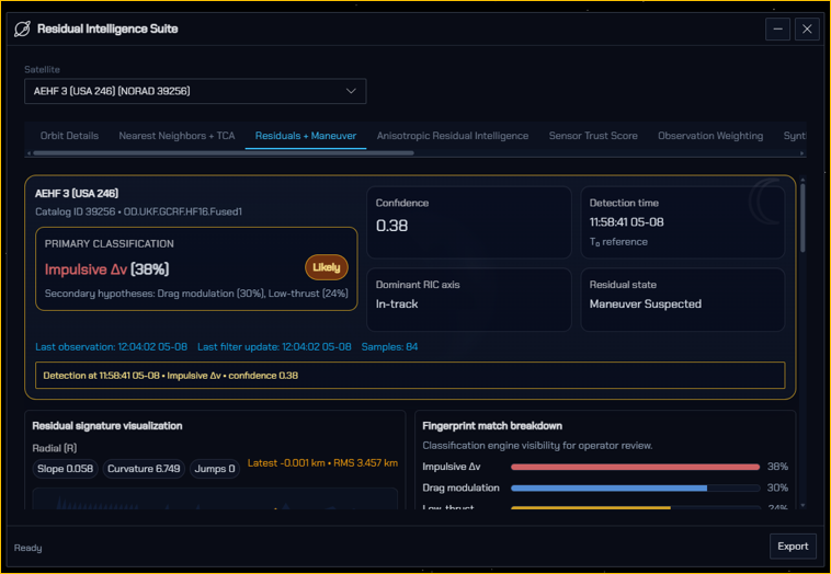
Maneuver Fingerprinting via Residual Shape Library
A physics‑grounded library of RIC residual shapes enables probabilistic, explainable classification of impulsive Δv events, low‑thrust behaviors, drag/SRP effects, plane changes, and station‑keeping patterns.
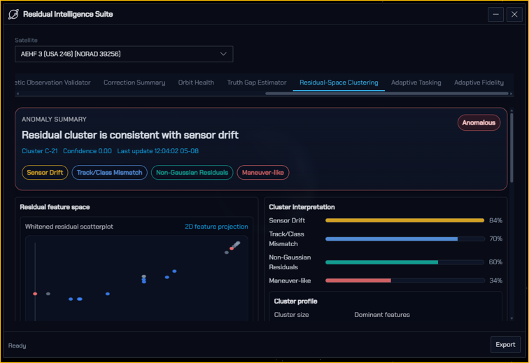
Residual‑Space Clustering & Non‑Parametric Anomaly Detection
Unsupervised clustering in whitened residual space separates maneuvering behavior, sensor drift, track inconsistency, and non‑Gaussian anomalies—creating an independent detection channel.
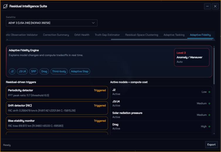
Adaptive Fidelity Engine (AFE)
Residual‑driven model selection activates appropriate force‑model fidelity (e.g., higher‑order gravity, SRP, drag) based on bias, whiteness, and spectral structure.
Sensor Trust Score & Residual‑Informed Observation Weighting
Real‑time trust scoring and adaptive weighting improve fusion stability, estimator consistency, and cross‑sensor coherence.
Synthetic Observation Validator & Truth Gap Index
Compares synthetic and real residual distributions to quantify realism, tune sensor models, and compute a Truth Gap Index summarizing distance to truth bounds.
Orbit Health Score & Explainability Layer
Unified metrics combine RMS, χ², bias stability, sensor trust, and maneuver likelihood to provide concise, explainable orbit‑health assessments.
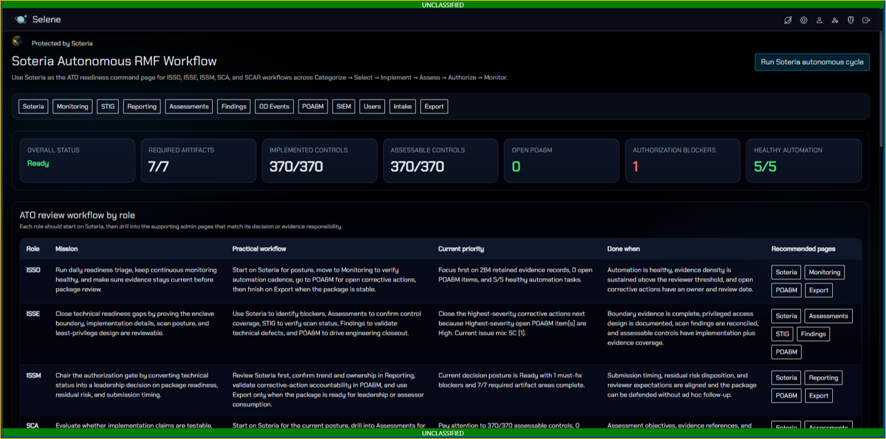
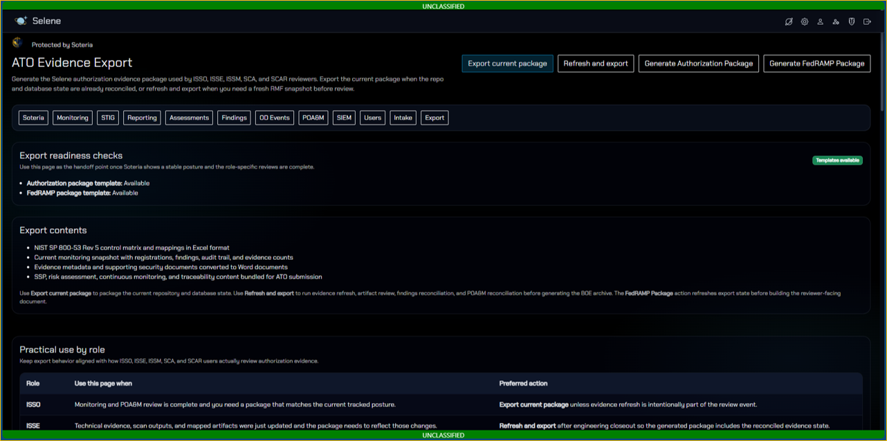
RMF Integration with Soteria
Soteria provides automated RMF workflow support, readiness tracking, and security‑evidence generation—enabling continuous monitoring and reducing time‑to‑ATO.
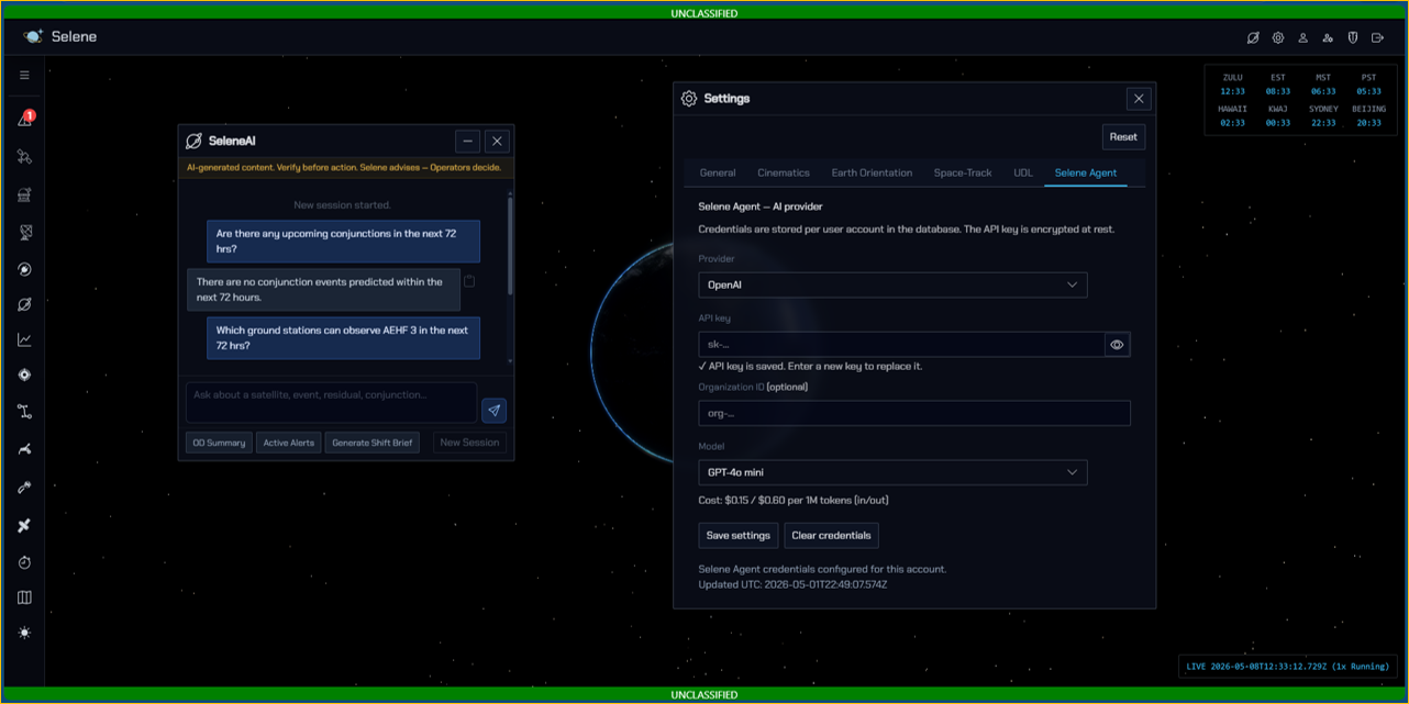
SeleneAI Experimental AI Assistant
A natural‑language agent capable of executing and evaluating Selene orbital, fusion, and threat‑analysis workflows.