Overview: From Experiment to Mission Workspace
Helios is an operational view of the space environment. An interactive 3D globe built to answer the questions operators ask in real time: Where is it? What can it see? What can we see? What’s changing? What needs attention now?
As an experiment, Helios tested orbital visualizations, SSA workflows, sensor context, and maneuver monitoring inside a single workspace.
"Helios is a workspace built for operations, not just visualization."
Orbital Workspace: Scene-First Operations
At the center of Helios is an interactive 3D scene designed to keep context: Earth, satellites, sensors, and overlays in a single continuous view. Helios presents satellites and assets on a continuously updating 3D Earth, powered by a high-performance rendering pipeline.
The intent is simple: keep global awareness in one view while still enabling deep dives on demand, without changing tools or losing context. This was the experimental bet; it is now the defining behavior.
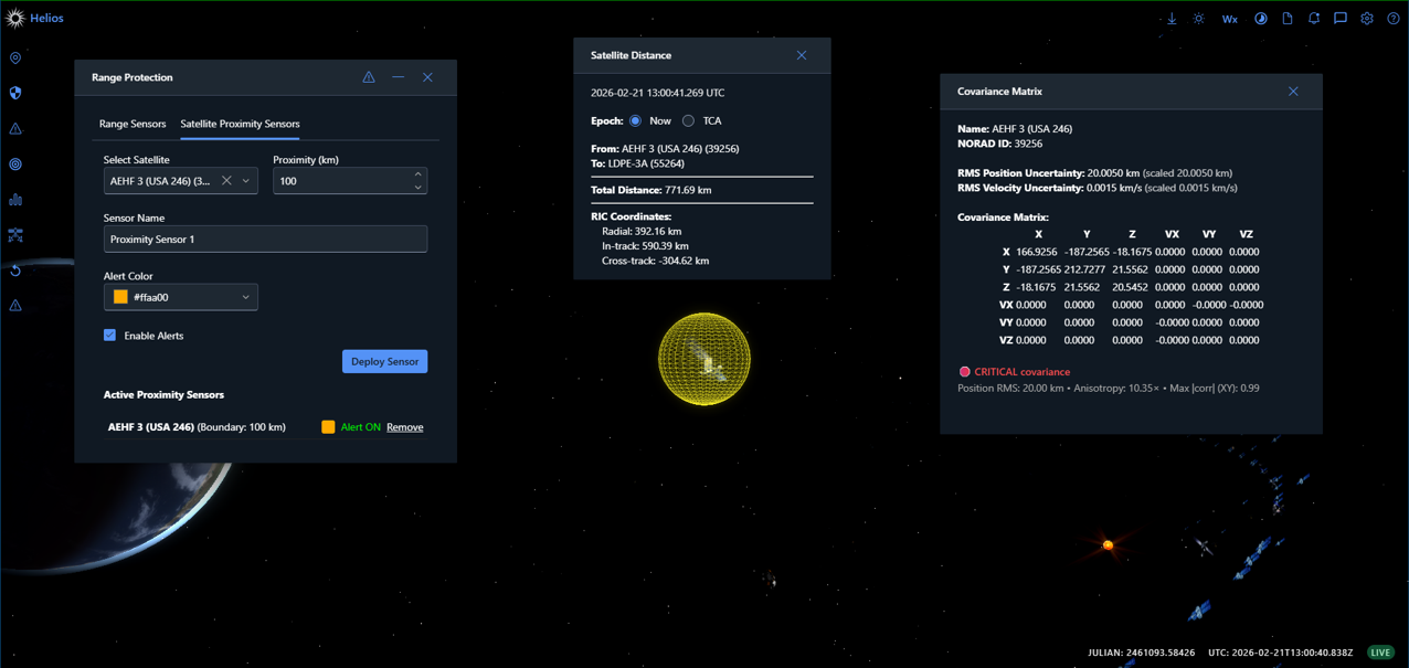
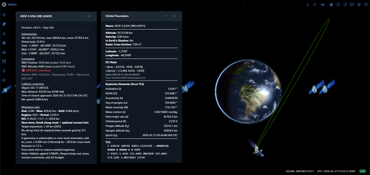
Popups and panels support deeper workflows, details, analytics, time controls, distance tools, and more, so the globe stays the primary interface.
Time Controls: Run the World in Real Time, or Any Time
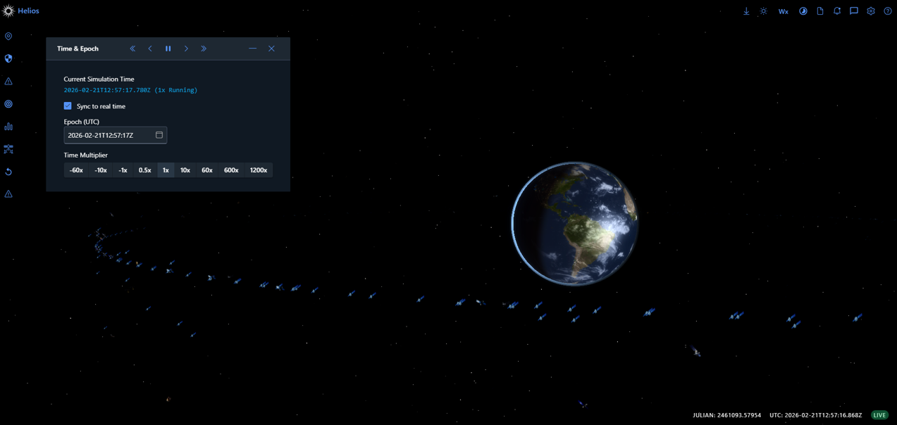
Helios includes a dedicated time control system for operational playback and forecast. Operators can work “Now,” replay “Then,” or accelerate “What’s Next.”
This makes time a first-class control surface. Analyzing a situation “as it happened” is as natural as watching it live. Helios treats time not as a parameter, but as an axis of understanding.
In practice, this enables reconstructing a situation at a specific UTC, compressing time to watch a pass or geometry change develop, and pausing to coordinate decisions without losing the state you’re looking at. Time becomes something you work with, not something you wait for.
Satellite Interaction: Right-Click Intelligence
Operators shouldn’t have to hunt through menus. Helios’s satellite context menu is designed around common operational tasks. Operators can quickly trigger tools such as:
The goal is to keep workflow latency near zero: point at an object, choose an action, get immediate context. This keeps the workflow consistent: select → act → assess.
True Footprints & 2D Operations Map
Footprints aren’t just “a circle on the map.” Footprints in Helios are implemented as true ground-intersection boundaries with a downward cone visualization.
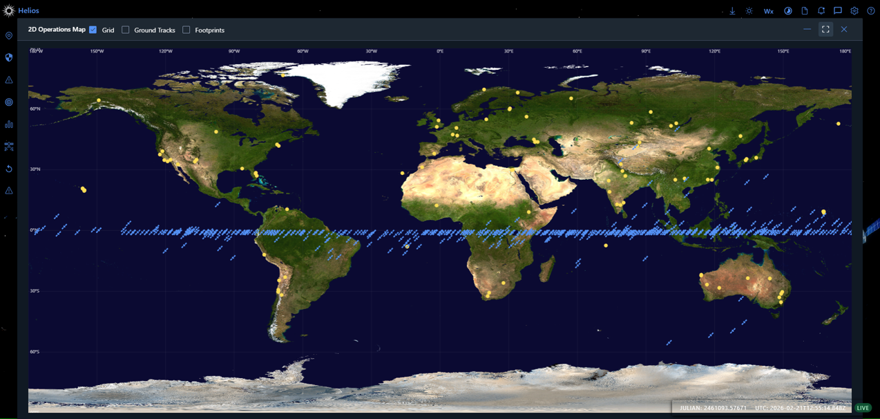
When a flat map is the fastest way to reason about the world, Helios provides a 2D Operations Map optimized for quick scanning and situational awareness:
Asset‑Centric Operations (Space + Ground)
Helios treats satellites and ground assets as operational objects. Operators can bring up relevant actions directly from the map, reducing time-to-assessment during safety windows.
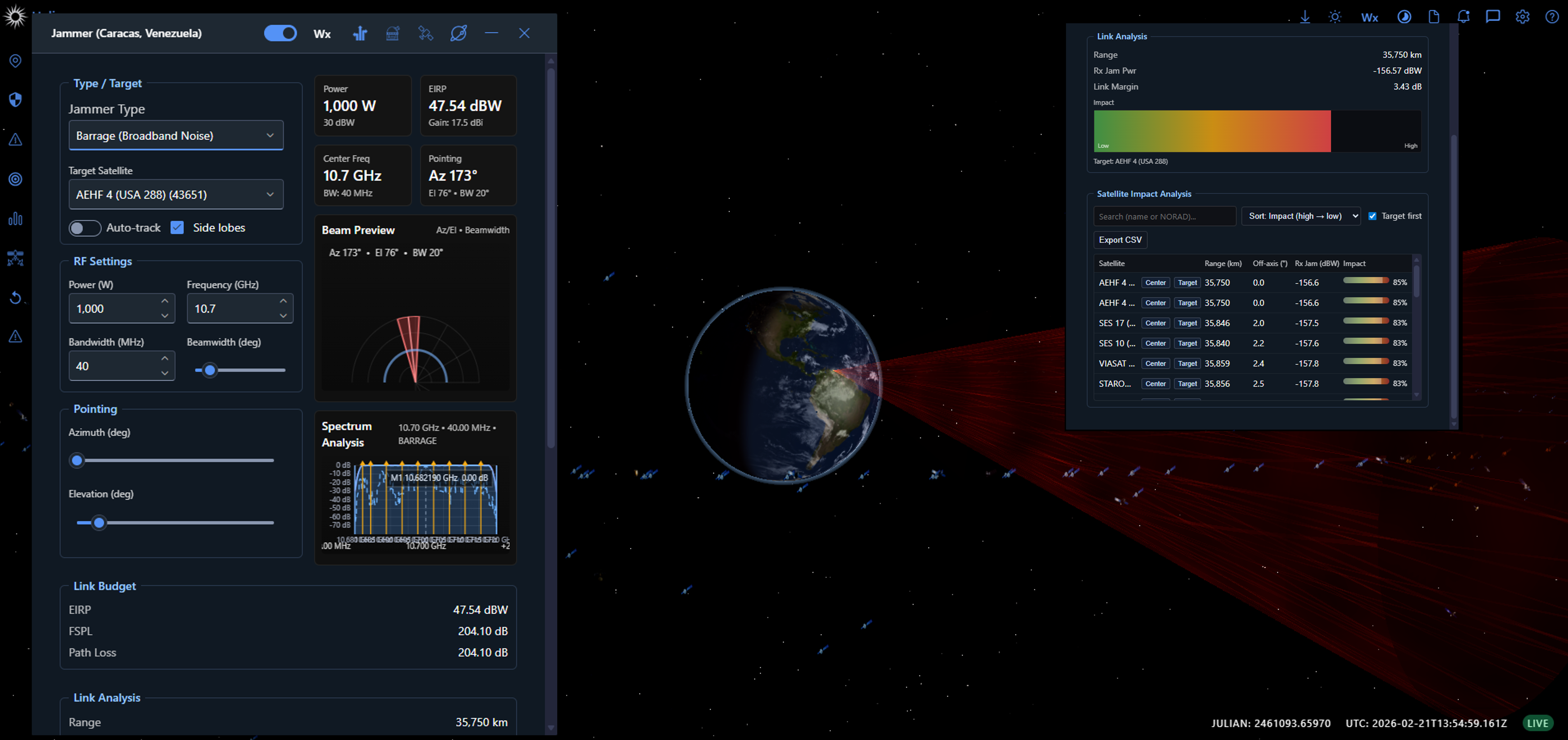
Ground sites are modeled with operational constraints (e.g., elevation, azimuth sectoring, and range envelopes). That means the scene isn’t just “where the site is,” but what the site can do.
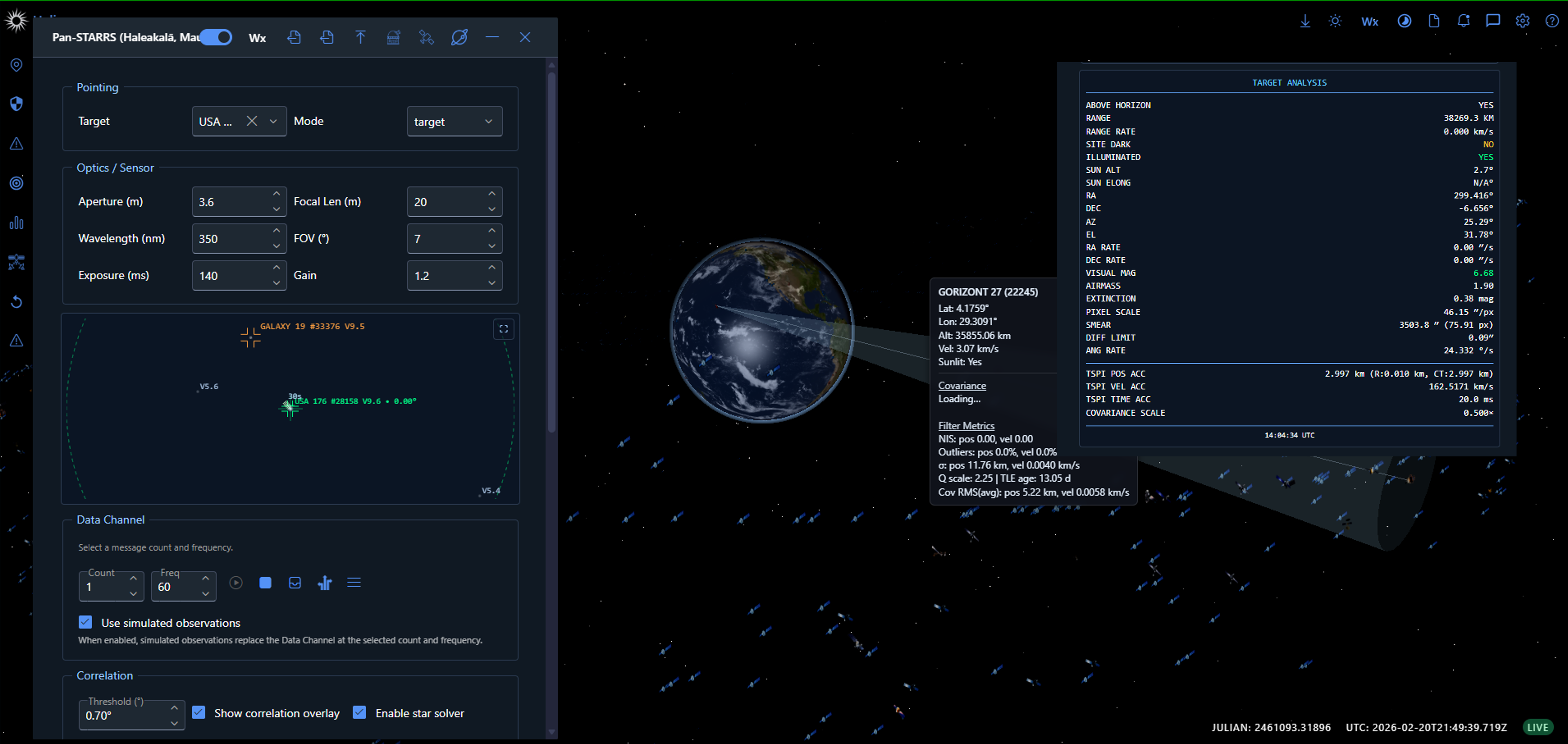
SSA Workflows: From Observations to Orbits
Helios includes a Space Situational Awareness Manager (SSAManager) supporting initial orbit determination workflows using Gauss, Laplace, Herrick–Gibbs, and angles-only methods.
SSA math lives inside the same workspace as orbital visualization, enabling operators to move from observations to orbits without leaving the tool.
Shift Turnover: Operational Continuity
Shift turnover is treated as a first-class workflow, aggregating active issues, risk indicators, upcoming close approaches, and timestamped turnover notes.
This reduces the “cold start” problem at shift change and keeps continuity inside the tool where the work happens. Result: faster turnovers, fewer missed details, and less time spent rehydrating context.
Under the Hood: Performance via Web Workers
Helios stays responsive during continuous orbital computation by offloading heavy math to dedicated web workers and streaming updates back to the UI.
In operator terms: the scene remains responsive even when the math is heavy. This was an experimental architecture choice that became a requirement.
Experiment Findings: Why Helios Works
01. Operators think in scenes, not screens.
Keeping Earth, satellites, sensors, and overlays in one continuous view improves situational awareness and reduces context-switching.
02. Time must be manipulable.
Operators need to replay, accelerate, and freeze time as naturally as watching it live.
03. Right-click is a doctrine.
Context menus reduce workflow latency and make orbital interaction feel natural.
04. Footprints must be trustworthy.
True ground-intersection footprints increase trust compared to simple circles.
05. SSA belongs in the workspace.
Embedding SSA workflows alongside visualization reduces friction and improves decision-making.
Open Questions
Open Questions: Where Helios Experiments Next
"Where should SSA math end and operator judgment begin?"
// Active area of development.
"What new overlays and constraints should be modeled next?"
// Active area of development.
"How should shift turnover artifacts evolve?"
// Active area of development.
"How can Helios-style workspaces inform future designs?"
// Active area of development.